Archive for the ‘How Fort Wayne’ Category

MAP: Specific differentiation between Mississippi Basin & Great Lakes Basin

Thursday, October 10th, 2013

From the document:
Wabash – Maumee Connection

Site Visit Field Report

July 27, 2010 

Prepared For:
U.S. Environmental Protection Agency Great Lakes National Program Office 

http://www.asiancarp.us/documents/Wabash-Maumee-Field-Report_Final_small.pdf

“Of primary concern are the Silver and Bighead carp which have been expanding their habitats within the Mississippi River basin for at least the past twenty years where they have decimated native fish populations by as much as 97 percent in some areas. These fish are currently threatening to enter the Great Lakes, a valuable fresh water resource.”   THIS is the specific location they are able to cross from the Mississippi via the Wabash to the Great Lakes via the St. Marys/Maumee.

“Asian carp have been known to exist within the Wabash River for nearly 20 years. However, in May 2010 Indiana DNR observed Asian Carp eggs and spawning behavior much further upstream on the Wabash than was previously anticipated. The Wabash River was a “dead‐ end” for these fish as the Roush Dam prevents Asian carp from reaching the headwaters of the Wabash River. However, the Little River connects to the Wabash below the dam and its headwaters ebb into marshland on the southwestern edge of Fort Wayne, Indiana. Due to its proximity to the Maumee River system and recent flood events that have occurred within the floodplains between these two systems, there may be an opportunity for Asian carp to swim across the drainage divide at this location between the Great Lakes and the Mississippi River Basins. This is a critical concern because the Maumee River flows into Lake Erie, thus providing Asian carp with a potential for direct access to the Great Lakes.”

EXACT Lake Erie/Wabash Watershed Boundaries in Allen Countyhttp://www.asiancarp.us/documents/Wabash-Maumee-Field-Report_Final_small.pdf


Proposed Interim Measures:
   Inspect and increase/reinforce existing berm as necessary.
  Fencing from Graham McCulloch Ditch berm to railroad embankment
  Place mesh grates at the ends of underground conduits or cover the openings on both ends with large rock to allow water to flow through but impede fish passage.
Potential Long‐Term Measures:
  Potential for a physical separation measure with a water level control structure located within or to the west of Eagle Marsh.
  Potential fortification of Huntington Dam.


Save Maumee remains concerned about the lack of any plan, IF the Asian Carp DO make it into the Great Lakes.  We are unaware of any reports, hypotheses or theories; what is the educated guess, as to the plan, if the Asian Carp are IN Lake Erie?

Purdue Publication RE: Allen County/Indiana Watersheds

Friday, September 13th, 2013


8 pages of solid information CLICK HERE:
Great Lakes Watershed / Allen County, Indiana

6 Watersheds in Allen Countymaumee map1


RiverFest at IPFW – Save Maumee Represented

Friday, July 5th, 2013

Presentation: June 22, 2013
  10:30AM – 11AM
Title: What can we do to make our 3 Rivers better; In-depth thought into surface water
Director, Abigail King said SMGO will release their new initiatives at RiverFest, that will “draw many eyes to the importance of water quality.”
“We plan to demonstrate the symbiotic relationship between stream health and how it is directly related to human health and recreation.”
By: Abigail King, Save Maumee Grassroots Organization Director & Founder

Secretary of Heartland Communities Inc. (Save Maumee’s nonprofit 501C3 fiscal sponsor)
Upper Maumee Watershed Partnership Treasurer
Maumee Valley Heritage Corridor; Region I Environmental Consultant
Abigail King and Bag Monster receive the collection plate from the UU!

Abigail King and Bag Monster receive the collection plate from the UU!

ACTIVE PRESENTATION FOR RIVERFEST ATTENDEES:

Save Maumee Grassroots Organization will be passing out native riverbank seed & chaff in salvaged reusable cotton-cloth bags at RiverFest.  SMGO wants these diverse and desirable contents to be planted on any local streambank.
Directions on the bag include, “if you want these seeds to grow, and work to improve water quality; only plant where nothing green grows, dirt is exposed, near an open water source, in an area that will NOT be mowed.  Then STOMP the seeds down flat with your shoes, flattening the open soil down, so it does not float away during the next rain.”
VICTORY for the RIVERS:
On 100% volunteer hours alone, Save Maumee has removed 26,728 lbs of rubbish from Fort Wayne’s Three Rivers. In place of the trash removed, the group planted over 2,000 trees and works to rehabilitate native species.  Since 2005, hundreds of volunteers have planted 900 lbs of seed and hundreds of pre-grown plants to slow erosion and sedimentation on riparian areas.  Strategies for erosion control through vegetation establishment has successfully promoted protection, raised awareness and inspired advocacy through educational hands-on projects.  To date, Save Maumee has been a 100% volunteer group that depends on the “kindness of strangers,” with donations and memberships from the public to support their work public events.
ACCOLADES:
  • 2008 through 2013, Save Maumee Grassroots Organization was chosen by Healing Our Waters to represent northeast Indiana for Clean Water Week in Washington, D.C., meeting with Federal Legislators.
  • 2011 Hoosier Environmental Council chose Save Maumee as “Indiana’s Organization of the Year”
One of our hundreds of volunteers, planting along the Maumee River

One of our hundreds of volunteers, planting along the Maumee River

The group encourages active public participation by joining Save Maumee at Hall’s Gas House from 7-8:30pm, the First Monday of Every Month Meeting.

Next meeting is August 5th, 2013 – ALL WELCOME
—————————————————
What’s in the reusable bag? Native riverbank seed & chaff, meaning it is the protective casing from the seeds & attached stalks, which help to keep the soil loose as propagation begins. These seeds are from the region, and will grow into plants that are acclimated to local climates and soil types and wildlife are adapted to this native vegetation. We want these diverse and desirable contents to be planted on any local streambank in an area that will NOT be mowed.

Directions:
IF you want these seeds to work to improve water quality;
1) only plant where nothing green grows & dirt is exposed, near an open water source
2) Stir up the soil with a stick or shoe and gently work the mix into the ground
3) cover with less than 1/4th inch soil
4) press down with your shoe to keep it in the ground.
ENJOY!~

Notice the prices reflect value of our natural resources, and they are going up because they are not getting any easier to find!
Hundreds of volunteers plant hundreds of "plant plugs" and trees!

Hundreds of volunteers plant hundreds of “plant plugs” and trees!

DIVERSITY is very important. COST TO PURCHASE (based on 2013 prices)
Prairie Drop Seed $15/oz or $225/LB
Common Milkweed $11/oz or $170/LB
Tall Iron Weed $18/oz or $265/LB
Wild Bergamot/Monarda $20/oz or $304/LB
Evening Primrose $5/oz
Acorns that grow into Oak Trees $7/LB

________________________________


IPFW Environmental Conservation Class-Field work with Save Maumee

Sunday, April 14th, 2013

Dr. Jordan Marshall – IPFW Environmental Conservation Class
Monday October 15, 2012 1:30– 2:30pm
Location: St. Joseph and St. Marys converge into the headwaters of the Maumee River – .7 miles downstream easterly
Hosey Dam (at N. Anthony Bridge) North bank of the Maumee River; (floodway/spillway- direct middle) sand, loam, clay, river sediment
NUMBER OF VOLUNTEER PARTICIPANTS – 24

Save Maumee Programing
Project with IPFW Environmental Conservation Class
In-kind student volunteers completed restoration project
CLICK HERE FOR PICTURES
In the floodway we planted 4 Pin Oak, 2 Mulberry, 2 River Birch, and one Hornbeam and 30 Oak Acorns into the stretch of river where Save Maumee conducts the majority of conservation projects.  As a group today, we also planted native DNR approved seeds; Big Blue Stem, Indian Grass, Switchgrass, New England Aster, Grass Leaved Goldenrod, Prairie Dock, Virginia Mountain Mint, Ironweed, Purple Coneflower, Monarda, and Black Eyed Susan and a few unidentified sedges.  We installed the seed blend under 19 feet of coconut mesh, called erosion-control-mats or GeoJute.  GeoJute is made from coconut fiber that will completely disintegrate in approximately 5 years. The coconut mesh is to hold down new life as the water raises and flows over the floodway.

Dr. Marshall brought it to my attention that several of the species I had mentioned may not do well under the tree canopy and prefer upland areas.  SO TRUE!  Different plants prefer different conditions.  The top of that seed bag, I had harvested myself, had a blend of seed.  With the experiment I have started in this area, I have found that not-ideal conditions still yield life! It just seems to stunt their growth, slowing their full potential for abundance.   For example, the Prairie Dock should be “full sun”, but they still were prolific this year!  These Prairie Dock were located on the high water mark, yet tree canopy covered.  Black Eyed Susan has been suggested by our consultant, Eric Ummel, from Earth Source/Heartland Restoration.  Black Eyed Susan has been extremely successful as shade tolerant in our efforts.

According to William Grant, retired Lagrange County Health Department Administrator, whom I personally interviewed in 2007. 

Wet Mesic Prairie Plants” are the suggested foliage for this area. “Wet Mesic Prairie Plants are a blend of plants that reduce nutrients and nitrates…ya know…these plants drink the stuff from leaking septic tanks, or dirty ditches.

Dr. Marshall and I could split hairs, because many of these (above listed) plants are lowland grasses that like it moist and prefer soils primarily loam or silt.  But I am still agreeing with Dr. Marshall, and appreciate his critique!  YES, some are not “suitable” for this area.

Remember: Not all the plants will grow specifically where we dropped them.  When the river rises, many will become dislodged and find different conditions downstream to germinate.  Planting seed does not happen in a vacuum, it is static.

Lesson Learned for Myself: When I asked Dr. Marshall about his thoughts on listening to me speak on two different occasions recently: 1) IPFW Anthropology Dept. Lunch-In   2) Environmental Conservation Class. He gave me some great feedback that I needed to hear.  We spoke of my reference to removing NATIVE wild grape vines.  The good Dr. said, “this is only a snapshot of the biology of this area…it is part of the process that nature is creating. You should think seriously about the promotion of removing natives…where did you hear that?”  So I wanted to clarify my thoughts on wild grape vine.

My erosion control projects started in 2005 and my research on our local rivers began in 2001.  I think I misspoke, or was not clear, about Vitis riparia.  This particular grape vine is prolific on my specific experimental floodway area on the north shore.  I have selectively chosen ones that are choking-out other trees and working to achieve and promote diversity of other species through selective removal of V. riparia.

Other State and County Park representatives discuss how they have invasive like Callery flowering Pear tree, Garlic Mustard, or Polk (Phytolacca Americana is native to southeastern U.S.)   Our riverbank does not have an over abundance of these because we remove them by hand, on sight.  We do not promote removing riverbank plants or using chemicals, of any kind, 300ft from the open water source.

Save Maumee is suggesting that every Japanese Honeysuckle (non-natives are hollow in the middle) you see should be removed.  The Japanese Honeysuckle has been shown to give local bird populations’ problems. Non-native berries do not provide the nutrients and minerals needed.  Birds will therefore spend more time foraging for more food because they are lacking nutrition.  This means they are not spending their precious time seeking a mate, nesting, nor tending to young.

These days many of the protected lands are managed.  They have a conservation target that is created through a management plan.  Many times the managed lands remove natives, like Cattails, because they smother other natives and discourage diversity around wet, stagnant water.  This too is important to note! Thank you Dr. Marshall! This brings up the point that my management plan has been in my head and I need to create one for my Lake Erie Waterkeeper, Save Maumee Steering Committee.

My conservation target from my head:
GOAL: SWIMMABLE, FISHABLE, DRINKABLE WATER
*raise awareness
*plant diverse native species:  slow erosion by slowing flood water as it violently runs over the floodway
to water takes a longer amount of time to naturally filtrate into the ground
*create this biodiversity through removing threats to the conservation target (i.e. removing invasives or overgrowth.

I will quote SaveMaumee.Org Website:

      Siltation/erosion/sedimentation is the #1 pollutant in our watershed.  The grasses will help to settle out suspended sediment in the water to help hold down the soil that could be washed away because there is nothing to hold down the barren soil when the water comes rushing down during a rain event.

      Grasses filtrate sediment by holding water for a longer period of time so the sediment settles to the bottom instead of traveling downstream.

      Removal of nutrients from the water before it passes downstream.

      Plants produce enzymes which will absorb and “eat” bacteria

      Natural removal of chemical pollutants like fertilizers and waste materials removes nitrogen, phosphorous and toxins from surface water.

      Creating more shade will help to create Dissolved Oxygen that is needed in the water for fish and other wildlife to “breathe.”

      Floods problems can be alleviated – grassy knolls and trees can capture, store and slowly release water over a longer period of time

      Protect shorelines through reduction of destructive energy from fast moving/ rising water

      Alleviate pools of standing, stagnant water so West Nile will not have the opportunity to be passed on in the mosquito or human population

Water quality, stormwater drainage and sewage issues recognize no political boundaries and need regional coordination.” (Plan-It-Allen, 2007)
The Upper – Maumee River Crosses 2 State Boundaries 4 County Boundaries Numerous Municipalities

Most people who live in cities downstream of Fort Wayne, use The Maumee River as their drinking water source.  Other drinking water sources would include wells.

Dear Dr. Marshall, I respect and took into consideration all of your suggestions, thank you.  Bringing students back into the field, instead of behind pencils, 3 miles away, is invaluable!  THANK YOU TOO STUDENTS! ALL our work to this point has been through the kindness of volunteers.  Please continue to keep an eye on us. We would love to have you at one of our meetings.  We would look forward to many of your perspectives!  Save Maumee Meetings are OPEN TO THE PUBLIC every 1st Monday of every month at Hall’s Gas House from 7-8:30pm.  Please feel free to comment on anything, because I truly value your opinion and your students’ opinions!

Today, October 28, 2012 – We are working to find out more about the removal of our plantings via City of Fort Wayne, Board of Public Works (BPW)from orders passed down to the Army Corps of Engineers (ACE).

On Wednesday, October 24 we witnessed all foliage cut and any tree under three-inches in diameter being removed, in our conservation target area.  We are now seeking the correspondence between the ACE and BPW regarding this sensitive situation.  I will keep you informed.  Makes me think now the grape vines were more important than I thought!

Celia Garza, Board Secretary

Sunday, April 14th, 2013

Where are all the trees? ~ It’s not JUST the Emerald ash borer destroying natural habitat.

The Army Corp of Engineers follows the “Guidelines for landscape planting and vegetation management at levees, floodwalls, embankment dams and appurtenant structures (ETL 1110-2-571)” when deciding what trees and plants to remove [on levees]. Downtown Fort Wayne has 8 miles of “downtown river front development” and 10.5 miles of levees next to our rivers. If you have any questions or are concerned with the removal of our natural resources, trees and plants, please contact the following City of Fort Wayne and other government employees:

image (2)image image (3)  image (4)

FORT WAYNE, INDIANA ARMY CORPS OF ENGINEER LEVEES (Detroit District) – CLICK MAP TO ENLARGE
10.5 miles are maintained by a non-federal agency/municipality = City of Fort Wayne Board of Public Works

#1   Tina Kowitz, P.E
Levee Safety Program Manager
Geotech & Structures Branch
U.S. Army Corps of Engineers, Detroit District
ph: (313) 226-6719
cell: (313) 244-6283

#2   Board of Public Works
Bob Kennedy – Manager (260) 427-2693
Shan Gunawardena – Engineer (260) 427-1172
City of Fort Wayne
Citizens Square Bldg. 2nd Floor
(260) 427-1112

#3  Federal Senator Dan Coats
Legislative Assistants:
Paige Hallen
Casey Murphy
Kate Taylor
493 Russell Office Bldg
Washington, DC, 20510
ph: (202) 224-5623

#4  Federal Senator Joe Donnelly
Legislative Assistant: Audrey Porter
SR-B33 Russell Senate Office Building
Washington, DC 20510
ph: (202) 224-4814

Thank you for calling,

Celia Garza
Save Maumee Grassroots Organization
Board of Trustees Secretary


HAPPENINGS!

Saturday, April 6th, 2013
Save Maumee Grassroots Office  800 Glasgow Ave.  Fort Wayne, IN 46803 2nd Floor

Save Maumee Grassroots Office
800 Glasgow Ave.
Fort Wayne, IN 46803
2nd Floor


2013 Earth Day Flier

EARTH DAY is Sunday April 21st from 11am-4pm

Map here for all the FUN on Earth Day!

 START AT STATION 1

Our social media outreach and updates have been sparse since my loving father AND our webguy, Brad Frost is very ill with cancer.

FIND ALL THE INFO ABOUT EARTH DAY HERE!

For more updates on a regular basis….check out our FACEBOOK!

Call if you need anything or would like to participate!
Abby 260.417.2500
EMAIL: Abby@SaveMaumee.Org

Steering Committee Chair Discusses Levee Maintenance

Thursday, January 17th, 2013

Save Maumee wants to talk openly with city officials, and with the taxpayers, about our waterways and the cause & effect of current practices relating to land use and water quality. The water we speak of is the same water we drink, bathe our children in, water our gardens with, and live alongside. It is our greatest natural resource.

Recently, the city hired a tree service to remove vegetation along the Niagara Levee (the same area Save Maumee has been repairing since 2005) for a levee inspection in December 2012. Conversations with Flood Control Supervisor Cathy Burleson revealed that the Army Corps of Engineers required much of this removal in their levee regulations that came as a result of Hurricane Katrina. She stated that she did not want to cut the trees down, ACE regulations required her to do so. Burleson also mentioned that there are 10.5 miles of levees that the City of Fort Wayne, Board of Public Works, are responsible for maintaining. Walk the River Greenway along Edgewater Avenue or Spy Run and you can see that definition of maintenance ~ removal of all trees and vegetation with the installation of rip rap. One small portion of Edgewater was developed using what was referred to as “green” technique (using vegetation surrounded by non-degradable, plastic mesh called Scour Stop at a large additional cost).

We understand the issue of levee safety in those areas are a priority, and are in complete agreement that the safety of the home and business owners, and their property are of utmost importance.  The last thing that we want is for anyone’s lives or homes to be in danger as a result of any compromising of the structure of the levees.

The problem that we seem to be having in Fort Wayne is the primary solution to control flooding is being addressed through removal of native plants and trees for “integrety of levee structures”.  It has been well documented in a vast amount of literature and studies (even those reported by the Corps, the EPA, and FEMA) that issues such as increased impervious surfaces, the use of rip rap, removal of vegetation, and removal of wetlands not only increase the likelihood that flooding will occur during peak seasons, but also that water quality will (and does) continue to decrease due to the removal of such areas.  Not to mention the effects on habitats and wildlife, both serving critical links in the food chain for humans and other wildlife.
Edgewater DURING removal of vegetation 2011

We have been observing the Board of Works cutting down “weeds” and “trees” along the levees because of the regulations that require them to do so, handed down by the Corps, in an effort to protect homeowners from flood waters.  We don’t see the Board of Works planting Willow shrubs in the allowable portions of the riparian areas or planting native grasses to assist in keeping the soil on the banks from eroding (as recommended by the Corps).  We only see them taking away from riverbank areas~and replacing trees, grasses, and shrubs with more impervious surfaces in floodways.  We don’t see the Fort Wayne Parks Department or City Planning making any concerted effort to decrease the likelihood of flooding by preserving natural areas with appropriate vegetation plantings to contain flood water (as a wetland would do).  Instead we see variances for housing additions, gas stations, strip malls, and pavement ~ all contributing to both flooding and decreasing water quality.

Edgewater levee AFTER vegetation removal & installation of Scour-Stop

The practices that are being used by our local government are antiquated procedures that are increasing the likelihood that our waterways will spill over during peak seasons.  We are urging the Corps and our city government to make more responsible choices when it comes to the overall picture, for Fort Wayne and for those downstream.  The Upper Maumee Watershed Partnership and the Army Corps of Engineers recognized in a 2009 report that the city of Fort Wayne’s Flood Control “projects are localized and do not address overall problems.”  It was recommended in this same report that riparian areas be expanded, and that the increase use of USDA/NRCS practices of restoring wetlands would help to decrease peak discharges into the waterways.  The city has made little effort to do either, instead relying on non-profit groups to do the work for them.

The riparian area that Save Maumee has worked on since 2005 is the only area of the Fort Wayne rivers where a riparian area is actively being re-established, thanks to over 300 volunteers who come out each Earth Day to repair that one small portion of the Maumee River ~ the Maumee is the largest watershed that flows into the Great Lakes.  Up to 80% of a stream’s water quality is inherited at its headwaters (Hoosier Riverwatch 2009); for the Maumee River, that is in Fort Wayne, Indiana.  Both the St. Marys and the St. Joseph Rivers (which come together to form the Maumee River)  are on the  2010 303(d) List of Impaired Waterways due to E. coli.  Other impairments that plague the rivers and watershed are Mercury, Nutrients, Free Cyanide, PCB’s, Siltation, and Ammonia ~ pollutants that impair the Maumee River from Fort Wayne to Lake Erie.

The installation of rip rap and removal of vegetation has been common practice along eroding areas of our rivers, increasing the speed of the water through the rivers after running off of impervious surfaces, thereby increasing the likelihood of soil erosion downstream from these areas and also the likelihood of flooding downstream as well. The city and county continuously allows the clearing of natural areas for development, areas that could be utilized to slow down water and hold it for storage until it has a chance to percolate through the soil via the root systems of native plants and recharge the groundwater supplies ~ which would also filter the water while decreasing soil erosion on the banks downstream.   The practices that are being utilized are actually increasing the problems and increasing the burden on taxpayers and homeowners.  We want to see our city and the Corps work to decrease the chances of flooding, while simultaneously decreasing that financial burden.

We understand that the position of the Corps is to maintain safe and secure levees, not to be involved in the local government issues.  The problem is that all of these water issues are connected and it does not appear as if there has been much effort from any of the decision makers to promote less invasive and more efficient and practical methods of dealing with flooding or water quality.  We are asking that the all involved decision makers begin to work toward more fiscally and ecologically responsible solutions on these issues.

Marissa Jones

Lake Erie Waterkeeper,
Save Maumee Steering Committee Chair
Marissa@SaveMaumee.Org

Cited Work:
Effects of Rip Rap on Riverine and Riparian Ecosystems.” Army Corps of Engineers Report, April 2003.

“Functions and Values of Wetlands.” Environmental Protection Agency, September 1, 2001. http://water.epa.gov/type/wetlands/outreach/upload/fun_val_pr.pdf

Engineering With Nature; Alternative Techniques to Riprap Bank Stabilization.” FEMA Report, modified January 2011.

“Landscape Planting: Objectives and Engineering Requirements.” Chapter 2. Army Corps of Engineers ETL 1110-2-571, 10 April 2009.

“Western Lake Erie Basin Study, Upper Maumee Watershed Assessment.” Western Lake Erie Basin Partnership, 3 August 2009.

Stewards of the Three Rivers of Fort Wayne

Friday, March 2nd, 2012

Abstract

Stewards of the Three Rivers of Fort Wayne:
By Rhonda Ladig Moxter

The Interaction of Government, Quasigovernment, and Nonprofit Organizations

In the pageant The Glorious Gateway of the West (Rice, 1916) celebrating the centennial of the state of Indiana, the prologue of the first scene discusses the magic that the three rivers of present day Fort Wayne meant to the native people.  In the prologue the pageant opens with a native musing, “Sacred this place.  For untold ages, long lost in the nameless years, my people came with ancient rites where these three rivers run under the shining sky” (p. 19).   Since the time before Fort Wayne was a city, with native peoples and settlers, the three rivers have been fought over as a source of food, water, transportation, business, and agriculture.  The battle over these rivers continues today, and the topics have changed surprisingly little.  But, though the circumstances have changed and the fight is just as passionate. 

Many groups and organizations have an interest in the health and well-being of Fort Wayne’s three famous waterways.  Local government plays a huge role in the decisions over how the waters of our river can be used by businesses and individuals, deciding what can and cannot be done to these waters.  Quasigovernment groups help support and facilitate the missions and directives of various groups of the government to promote, protect, and educate on various aspects of the waters and rivers of Fort Wayne and the surrounding area.  Finally, nonprofit and grassroots organizations, some 50 years old and some created in the last several years, charge themselves with shielding the lands and bodies of water that effect Fort Wayne’s three rivers.  Being stewards of these three rivers is no straightforward, easy feat.  It involves the consideration of factors that far outreach those of the rivers themselves.  And, each of these umbrellas, the government, quasigovernment groups, and nonprofit and grassroots organizations work with one another, whether they meant to or want to, to fulfill their interrelated missions.

City Government

The City of Fort Wayne has a problematic sewer system because of the combined sewer system and its subsequent overflow problem.  A combined sewer system has two pipes that direct general rain water to the river and household sewage to the water treatment plant.  However, after a heavy rain, the system gets overloaded and sewage is dumped into the river, thus creating a combined sewer overflow, abbreviated CSO (CSO, 2011).  Fort Wayne has this type of system and suffers from this situation though it is not unique to Fort Wayne, with as many as 770 other cities in the United States suffering from the same situation (Brugger 2011, slide 4).  In compliance with the Clean Water Act , municipalities address these overflows into local waters (Brugger, 2011).  The Clean Water Act was created in 1972, but the Environmental Protection Agency (EPA) did not begin enforcement of the combined sewer system provisions until 1994 (Brugger, 2011).  To meet these standards, which the city was in violation of, the EPA developed and sent a plan stating what the City of Fort Wayne needed to do to become compliant (Brugger, 2011).

In response to this plan, which was vast and very expensive, in 2001 the city developed a preliminary action plan for the EPA laying out how Fort Wayne could become more compliant with the provision (Brugger 2011, slide 4).  The first step was to begin analyzing the costs and benefits of reducing the overflow number from the current average of 71 overflows per year down to a more manageable number (Brugger, 2011).  According to the city’s Senior Project Manager, Justin Brugger (2011), in an ideal situation it would be possible to stop all overflows; however there are far too many factors to consider that complicate this situation and make negotiating with the EPA for a reduction of overflows the most effective solution.  After careful study, it was determined that decreasing the number of overflows per year to 4 had the greatest cost-benefit to the city, thus reducing the overflow volume from an average of 1 billion gallons of sewage dumped into Fort Wayne’s waterways, to 100 million (Brugger, 2011).  The cost of the entire CSO plan that the city purposed to the EPA, which includes additional storage, upgrades, and improvements, in 2005 dollars, was $239 million (Brugger, 2011, slide 10).

After determining the best approach for the city and going into negotiations with the EPA, a consent decree was signed with the City of Fort Wayne in December 2007 (Brugger, 2011).  The consent decree, essentially, is a voluntary agreement between the EPA and the city that allows for a solution to the situation without legal action (Brugger, 2011).  The decree satisfies many of the EPA’s demands, but protects the city from spending money on projects to fix the combined sewer overflow and then being told that they had not done enough, thus having to spend more money (Brugger, 2011).  Politically at this time, Fort Wayne had a lame duck mayor, with elections approaching the following year (Brugger, 2011).  The EPA knew that it would be harder for a new mayor to get the backing to spend the money needed on the CSO problem, so they were more agreeable to the final plan than they may have been had the city not been in this political situation (Brugger, 2011).  Additionally helpful in obtaining the agreement with the EPA was that, at the time of the consent decree, the city had already completed several projects to fix the CSO, for example creating storm sewers, completing water treatment and sewer plant improvements, and establishing a public notification system for when overflows occurred (Brugger, 2011). 

The overall cost of this project equals 383% over an 18 period (Brugger, 2011, slide 14).  How will the city balance the protection of the rivers, while still protecting citizens and businesses from taking on the whole of the costs?  One idea from Justin Brugger (2011) would be to raise property tax to offset the costs, but with Indiana’s property taxes being capped by the state at 1%, this option will not work.  Another option would be to pursue grant money from outside sources to help counterbalance costs, but grants are not an attractive option for local government projects because they are often complicated and more work than they are worth to get and maintain (Beier, 2011).  Another idea proposed by Brugger (2011) would be to raise the sales tax by 1/2 percent.  This idea is appealing because it would allow those who are using the city’s utilities to pay for them (Brugger, 2011).  In theory, if someone from an outlying community comes to the city to shop or eat at a restaurant they will using the city’s utilities during that time and, thus, they money they were spending in the city would be paying for them in an additional percentage of tax on their purchase.  The problem with this solution is that it will likely be unpopular to raise this tax from 7% to 7.5% and it would not be completely fair to have the tax rate in the city pay for the CSO fix, when communities outside of the city also use the utility, for example Leo-Cedarville and Huntertown (Brugger, 2011).  So, a final option, and the one the city will likely pursue, is to raise the cost of utilities (Brugger, 2011).  According to Brugger this would make the average utility bill for a Fort Wayne resident around $100 per month by the year 2023 (Brugger, 2011).

Could this have an effect on urban sprawl, causing city residents to move out of the city to avoid the high cost of utilities (Brugger, 2011, slides 22-3)?  If that were to happen, what would the impact be on property values in the city’s neighborhoods?  And, if property values are affected, what would then be the impact on the school system, which is funded by property tax (Brugger, 2011, slides 24)?  Also, could the residents of the city, who are dealing with a severe level of underemployment, afford such an increase (Brugger, 2011, slides 25-6)?   All of these factors must be carefully considered and balanced against the mandate to reduce these sewage overflows into Fort Wayne’s rivers.  Other groups have feelings on what happens to our rivers as well.

Quasi-governmental Organizations

            Merriam-Webster (2011) dictionary defines the term quasi-governmental as “supported by the government, but managed privately.”  Quasi-governmental groups are a complicated web of groups that are interconnected with local, state, and federal groups to uphold and fulfill their missions.  One of these groups working to improve the region’s water quality is the Allen County Partnership for Water Quality (ACPWQ).  To understand how complicated these quasi-governmental groups can be, see the explanation of the layout of this organization from its Water Resource Education Specialist, Matt Jones (2011):

The ACPWQ is a county organization.  I work under the supervision of the Allen County Soil and Water Conservation District (SWCD).  Most SWCDs in the state are involved in some way with the NPDES program.  That being said, they have a professional organization at the state and national levels … these organizations have little to do with my day-to-day activities and only offer professional training opportunities and information to SWCDs.

 The SWCD and ACPWQ are housed … in a federally administered building that houses the Natural Resources Conservation Service and the Farm Service Agency branches (NRCS and FS, accordingly) of the USDA [United States Department of Agriculture].

The ACPWQ works in this complicated mix of governing bodies through the Clean Water Act’s National Pollutant Discharge Elimination System (NPDES) permit program (Jones, 2011). 

These NPDES permits, issued by the EPA’s Office of Water Management, help to regulate the sources of surface water pollution such as pipes or ditches that run into rivers (OWM, 2011).  In this region, permit holders include Allen County, Leo/Cedarville, Huntertown, the City of Fort Wayne, the City of New Haven, Indiana University-Purdue University Fort Wayne, St. Francis University, Ivy Tech Community College, and Indian Tech (Jones, 2011).  The monies from the permits are used to fund the ACPWQ through its partner groups including the Allen County Soil and Water Conservation District, the Fort Wayne-Allen County Board of Health, the St. Joseph River Watershed Initiative, and the Maumee River Basin Commission (Jones, 2011).   These funding partners communicate regularly with the ACPWQ to fulfill the role of educating local groups, from students to lawn care professionals, on water quality issues that they may effect, or that may affect them (Jones, 2011).

            Another regular audience of the outreach and education programs provided by the ACPWQ are local farmers.  The requirements under the Clean Water Act that regulate urban and suburban areas do not extend to farms (Jones, 2011).  Because of this, the ACPWQ uses its resources to reach out and educate farmers on best practices for water quality (Jones, 2011).  The farmers have the choice of whether or not to comply, and because the majority of Allen County is farmland, it is in the best interest of the region’s water quality for as much dialogue and education to happen between the ACPWQ and local farmers (Jones, 2011).

            Though the ACPWQ does not work directly with the nonprofit groups, Jones (2011) states that because of its broad scope, his organization frequently has knowledge of the many existing nonprofit and grassroots groups in the region and can often be a resource to encourage collaboration or connect several groups when their missions or events overlap.

Nonprofit and Grassroots Organizations

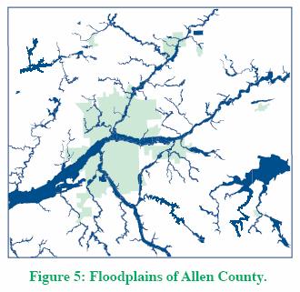
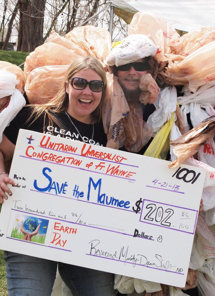
            Many nonprofit and grassroots organizations play a role in Fort Wayne’s three rivers.  The group Save Maumee Grassroots Organization (or, Save Maumee, for short) was formally established in 2005, but the focus on the Maumee River all began in 2001 when Abby Frost King (then, Abby Frost) moved to her home near the river.  In an interview with Frost King in 2011 she states that she had dreams that her children would play on the banks of the river, swimming and fishing in the waters.  When friends and neighbors heard of this, they were appalled and explained to Abby that the reason why was the poor state of the Maumee (Frost King, 2011).  When Abby discovered the state of the river and its surrounding ecology, she began crusading to clean up the river and prevent future damage, as well (Frost King, 2011).  According to the group’s most recent available newsletter, 80% of a stream’s water quality is inherited at its headwater and the Maumee is fed by the St. Mary’s and St. Joseph rivers, therefore the group is also has some interest in the city’s other two rivers (“Understanding”, 2011). 

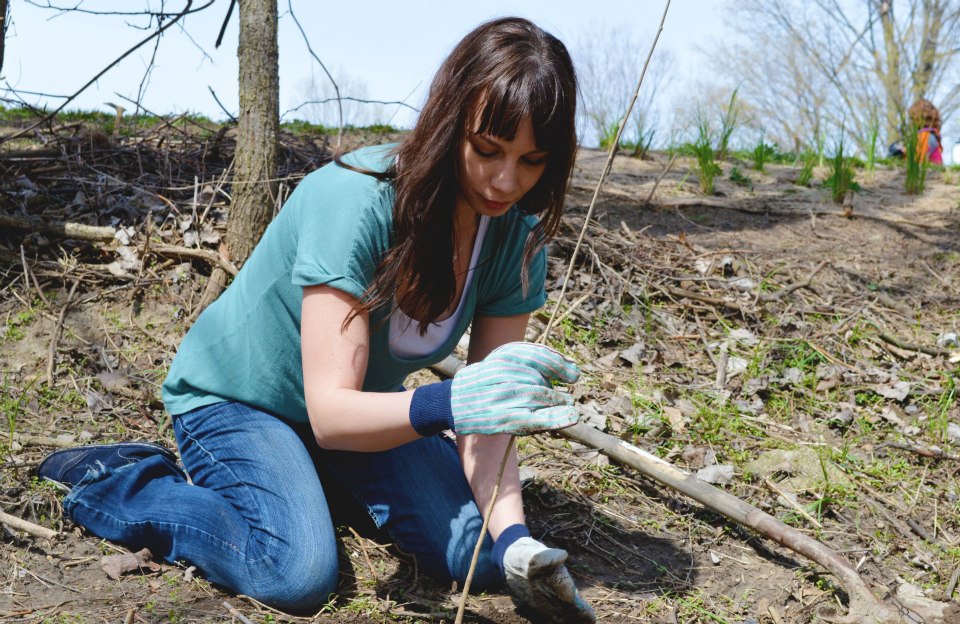
            The foci are multi-faceted for the group.  Save Maumee focuses on the health of the rivers in direct effect of the economy, aesthetic, recreation, and health of the Great Lake Basin (“Understanding”, 2011).  The group relies on volunteers to remove garbage that makes its way in the rivers through direction pollution and also from trash flowing into storm drains that flow into the rivers during a rain (“Understanding”, 2011).  (According to Justin Brugger (2011), this will be the biggest impact the citizens will see once the combined sewer overflow issue is resolved; there will be much less trash flowing into the rivers.)  Volunteers for the Save Maumee also cultivate seed and then plant them along the river to aid in erosion control of river banks (“Understanding”, 2011).  They also plant trees, wild flowers, and other plants annually to increase diversity and help reverse pollution (“Understanding”, 2011).   

            Besides the physical work of saving the rivers, much of what Frost King and Save Maumee do is simply trying to get enforcement on laws and regulations that are already in existence.  For example, one focus of Save Maumee is greater enforcement and oversight of National Pollutant Discharge Elimination System (NPDES) and combined sewer overflow controls already in place by the EPA (“Understanding”, 2011).  Save Maumee also pushes the Clean Water Act’s mandate that surface water meet defined standards (“Understanding”, 2011).  As per the act, the standard was to have been met by 1983, though in 2011 the city’s rivers are far from meeting this standard, evidenced by being on the EPA’s 303(d) list in 2011 (“Understanding”, 2011).  Under section 303(d) of the Clean Water Act, states are required to list impaired waters (“Impaired”, 2011).  Additionally under this section, states must rank the severity of the impairment of the bodies of water by clearly stating their total maximum daily load, which is a calculation of the maximum amount of a pollutant that the body of water can receive and still meet water quality standards (“Impaired”, 2011).

            A specific area that Save Maumee is looking for enforcement of existing provisions is in the Maplecrest Extension Rd. project.  The road extension is being built over the Maumee River.  According to Frost King (2010), the construction company that is completing the project had not used erosion control techniques, which are required with construction permits on a floodplain, and had subsequently filled in the entire river bed.  Frost King then filed a complaint with the Allen County Soil and Water Conservation District, a quasi-governmental group dedicated to the “wise use of our soil, water and related natural resources” (ACSWCD, 2011).  This group had no power to stop construction, but just did cite the violations and communicate them to the County Council (Frost King, 2011).  Frost King then contacted the Indiana Department of Environmental Management and had to wait several weeks for the department to show up for an inspection (Frost King, 2010).  Per Frost King (2011), the issue was never resolved during construction of the road though all avenues for enforcement were tread.

            Besides fighting to enforcing oversight and getting their hands dirty, Save Maumee Grassroots Organization also pushes for policy changes.  One such push is to rezone Indiana’s wetlands as protected areas, because of their benefits to the waters and watershed of Northeast Indiana (“Understanding”, 2011).  Currently, in the region, wetlands are zoned as “other” instead of as a protected body of land (“Understanding”, 2011).  Save Maumee is not alone in this particular fight.

Another Northeast Indiana nonprofit group working to protect wetlands is the Little River Wetlands Project (LRWP).  This group is also a relatively young nonprofit, beginning in 1990, with a mission “to restore and protect wetlands in the Little River watershed and to provide educational opportunities that encourage individuals to be good stewards of wetlands and other natural ecosystems” (Nolan, 2011).  Wetlands are vital to a healthy ecosystem in Northeast Indiana because they have an important impact on improving water quality, storing floodwaters, and holding surface water during periods of drought (“Functions”, 2001).  These vital lands in Northeast Indiana have diminished by 85% and the LRWP works to restore and protect the wetlands as well as educate about the importance of their mission and works (Nolan, 2011).  In this effort, LRWP has teamed up with ACRES Land Trust, another local nonprofit group that has been working in the area since 1960 to preserve land in its natural state in the face of growing urban areas and land development (ACRES, 2011).  With many nonprofits spending much time and energy on securing reliable funding, LRWP and ACRES have helped bridge that gap by teaming up to accomplish both of their respective missions in LRWP’s first shared-purchase property between the two groups (Nolan, 2011).

Conclusion

            What can we conclude from the above narrative of the groups that work for water quality in Northeast Indiana?  We see that these different types of groups, governmental, quasi-governmental, and nonprofit, have varying directives and missions and challenges, but their efforts often cross-over with the same goal in mind:  improving the quality of the water of the three rivers.

            For the city government, the challenge is balance.  They must consider all stakeholders and factors in every decision made to clean and protect the waters.  The federal government has mandates that the city must meet, and they are often expensive.  Finding the perfect balance of doing what is best for the rivers, local businesses, city finances, school systems, wildlife, and family budgets is a multi-faceted and demanding tight wire to walk.  For nonprofit and grassroots organizations, they’re missions and directives are often narrow and specific, but is a part of a vast, complex system with innumerable factors.  This is its own challenge as the successes are measured in small victories, but the aspects involved to get those victories are often large and convoluted.  For the quasi-governmental organizations, they often work in a scope of no actual regulatory power, with many “bosses” to answer to in the sense of the groups providing the funding that have their own individual needs they expect to be accomplished through the organization. 

            In many parts of the United States (and, truly, the world) discussions of water have to do with control, but in Northeast Indiana the question is not one of quantity but of quality: there is plenty of water, but that also means there is plenty to abuse.  The many groups and organization dedicated to minimizing and reversing that abuse face some common challenges.  First and foremost is a lack of cohesive enforcement of existing laws and regulations that were established to prevent abuse.   Next, as is the case in many situations that involve social issues, there are often “turf wars” as the multiple groups fight for the limited resources available as they look to fulfill their related but divergent missions.  Another common challenge is the idea of group think, in that a group moves in a self-defined direction and eventually becomes disconnected with the reality of the situation, people, events, and concepts with which they are working.  But perhaps one of the largest challenges on this issue is that of focused, forward thinking leadership.  Until all parties that make the rivers their missions can come together and discuss all of these challenges and opportunities, they will likely continue to push against one another and spin their wheels.  In his book The Power of Collaborative Solutions, Tom Wolff (2010) tells a story of a social worker that received a request for the mother of a child with whom the social worker dealt.  When the social worker arrived at the family’s home at the scheduled time, she found a room full of others waiting.  The mother came in and told the group, “You are all social workers working with our family.  I am going to leave the room.  It would be really helpful for our family if you would talk to each other” (p.1).  A room filled with the rivers’ “social workers” addressing the issues, needs, and future would be a natural first step to the long, but worthy discussion involving all of the people that are passionate about Fort Wayne’s waterways.  There will always be groups that want different things for our rivers, but with a common energy, the biggest impact can be made. 

And a big impact is what Fort Wayne’s rivers, in all their history and glory, deserve.  At the conclusion of The Glorious Gateway of the West (Rice, 1916), one of the settlers states, “Bless these people of Fort Wayne in all their comings and goings. … Bless this new State of Indiana and give it prosperity and true happiness.  Bless this meeting place of the three rivers and prosper it and all who shall come to it to make them a home, now and forever.  Amen” (p. 59).


References

ACRES purpose and history. (n.d.). ACRES Land Trust. Retrieved November 27, 2011, from http://www.acreslandtrust.org/628207

Allen County Soil and Water Conservation District. (n.d.). Retrieved November 27, 2011, from http://www.allenswcd.org/

Beier, B. J. (2011, February 23). Lecture presented at SPEA V504 – Public organizations in Indiana University-Purdue University Fort Wayne, Fort Wayne.

Brugger, J. (2011, March). Sewers and public policy. Lecture presented at SPEA V264 – Urban structures and policy in Indiana University-Purdue University Fort Wayne, Fort Wayne.

Brugger, J. (2011, November 22). [Personal interview].

Frost King, A. (2011, October 4). [Personal interview].

Frost King, A. (2010, October 14). Being cordial to an urgent issue – Maplecrest Extension brige [Web log post]. Retrieved November 27, 2011, from https://blog.savemaumee.org/2010/10/14/being-cordial-to-an-urgent-issue-maplecrest-extension-bridge/

Jones, M. (2011, November 17). [Personal interview].

Jones, M. (2011, November 28). Water rights questions. [Email to the author].

Quasi-governmental. (2011). Merriam-Webster.com. Retrieved November 28, 2011 from http://www.merriam-webster.com/dictionary/quasi-governmental

Nolan, S. (2011, November 8). Phone/email interview [E-mail to the author].

Rice, W., & Goodman, K. S. (1916). Scene I, prologue. In The glorious gateway of the west: An historic pageant of the story of Fort Wayne, commemorating the one hundredth anniversary of Indiana’s admission to the sisterhood of states (ps. 19, 59). Fort Wayne, IN: Centennial Association.

Understanding the depth of Northeast Indiana water related issues. (2011, February). Save Maumee Grassroots Organization.

United States of America, Environmental Protection Agency, Office of Waters. (n.d.). Impaired waters and total maximum daily loads. Retrieved November 23, 2011, from http://water.epa.gov/lawsregs/lawsguidance/cwa/tmdl/

United States of America, Environmental Protection Agency, Office of Waters. (2001). Functions and values of wetlands (EPA 843-F-01-002c). Retrieved November 25, 2011, from http://water.epa.gov/type/wetlands/outreach/upload/fun_val.pdf

United States of America, Environmental Protection Agency, Office of Waters Management. (n.d.). Retrieved November 24, 2011, from <http://cfpub.epa.gov/npdes/index.cfm>.

United States of America, Environmental Protection Agency, Office of Waters Management. (n.d.). Combined sewers overflow. Retrieved November 23, 2011, from http://cfpub.epa.gov/npdes/home.cfm?program_id=5

Wolff, T. (2010). Why Collaborative Solutions? How our Helping Systems are Failing Us. In The Power of Collaborative Solutions: Six Principles and Effective Tools for Building Healthy Communities. San Francisco, CA: Jossey-Bass.

Written By Rhonda Ladig Moxter
Contact Rhonda by email     rrlpdmt@hotmail.com

Combined Sewer Overflows – college term paper

Saturday, February 11th, 2012

Combined Sewer Overflows


Written by Sean Musi

V161


I have spent half of my life in Fort Wayne, Indiana and the number one issue that comes to mind involving the environment is the poor condition of our water ways. This is especially upsetting because the city seems to take some pride in the fact that three rivers meet in it and even have a large week-long festival named after it, Three Rivers.


My mind went straight to a presentation given by a local grassroots project while I was studying at my previous college in Fort Wayne. Abigail Frost, founder of Save Maumee Grassroots Movement, spoke about her current efforts as well as how these three bodies of water came to be as unpleasant as they are today.


The St. Joe River is where over 200,000 people get their drinking water. This meets the St. Mary’s and both then flow together to create the Maumee. The St. Mary’s, which floods frequently and is highly polluted, passes through much of northeast Indiana. These two rivers come together to form the Maumee, which contains high levels of mercury, PCB and E. coli.,fish consumption advisories, as well as the accumulation of sediment and garbage. The Maumee just so happens to be the longest and largest contributing river to the Great Lakes (Frost).


The Maumee has been polluted since before January of 1975, which is when the EPA conducted an investigation on it as well as the section that passes through the Toledo area(Water). The legal release of pollutants by 38 industrial contributors has taken a toll on the health of these rivers. The Indiana Department of Environmental Management has been criticized because of its inability to enforce when these regulations are violated (Frost).


Another contributing factor is the outdated and degrading status of the sewer system. Combined sewer overflows (CSO’s) take storm water runoff, sewer discharge, and industrial waste to all be processed at a water treatment facility. With heavy rainfall or snowmelt thesesystems are designed to overflow into nearby streams, rivers or bodies of water when capacity is exceeded. In Fort Wayne this can happen when 0.1 inches of rain falls. On average this amount of rain is produced 71 days out of the year. In 2006 it happened every 2.4 days. These overflows mean that one billion gallons of raw sewage are being dumped into the rivers each year (Frost).


As mentioned before the Maumee is the longest and largest contributing stream to the Great Lakes. This means that the pollution of this river has a negative impact on all the communities and wildlife from Fort Wayne to the Great Lakes. The Three Rivers Festival used to have a Raft Race and there also used to be a beach at the Johnny Appleseed Park, but because of excessive pollution are now unfeasible (Frost)This takes away additional revenue these activities may have produced for the city or local businesses as well as a uniqueness that may have made the city an attractive place to live or visit. Boating enthusiasts as well as fishermen are deterred from using these waterways for their recreation due to their poor condition, adding to the negative economic effects as well as social effects. Indiana University Purdue University Fort Wayne (IPFW) is situated on the bank of the St. Joe River. They have recently constructed a beautiful bridge for pedestrian and bike traffic to the soccer fields on the other side of the river.However, the poor quality of the water than runs under this bridge could potentially have a negative effect on the likelihood of a student or student athlete deciding to attend this college. Thus losing tuition money as well as revenue this athlete may have produced. Elite professors and or students deciding not to come to this school because of the poor environmental aesthetics may hinder the chances that IPFW makes a household name of itself. This snowballing effect can all this could be traced back to a series of polluted rivers.


There are solutions to help prevent or eliminate the number of overflows a city can take that has a combined system. The first is to modify the existing system to separate the wastewater from the runoff water. The city of Minneapolis is aggressively pursuing this solution to their CSO’s. Separation started in the 1960’s and CSO’s are rare compared to other cities. Remaining combined sewers are still in place there due to the difficulty and expenses to separate them. Part of this problem is up to the home or business owner. If built prior to 1961 many structures have piping that runs off the roof and directly into the sanitary sewer system. Redirecting this water onto grade or to a storm drain on the street are the primary solutions (Minneapolis).


Another avenue of solutions leans more toward urban forestry. Riverkeeper, a member-supported watchdog organization, has also addressed the problem with CSO’s that discharge into New York Harbor. “More than 27 billion gallons of raw sewage and polluted stormwaterdischarge out of 460 combined sewage overflows (“CSOs”) into New York Harbor alone each year” (Riverkeeper). This organization proposes implementing green streets, street trees, green roofs and rain barrels. Green streets are areas that use vegetated facilities to manage stormwaterat its source. If applied in New York City it could reduce CSO’s by 14,800 gallons. Implementing street trees could reduce an additional 13,170 gallons of water from CSO systems.Another way is through green roofs, reducing 800 to potentially 12,000 gallons. Utilizing rain barrels can subtract 9,000 gallons (Riverkeeper).


Seeing how these rivers are intricately connected to the city of Fort Wayne as well as all the communities to the Great Lakes calls for immediate action, especially Fort Wayne. Being the “Summit City” all the poor environmental practices carried out here will unfairly punish communities who may be carrying out safe methods. Fixing this problem has nothing but good outcomes for all. Cleaner rivers where those 200,000 people get their water increases their health as well as that of the environment. Cleaning these rivers may also add to the attractiveness of the city and add population growth, industry growth and overall prosperity.  


Like all policies there will be consequences of implementing them and these proposed solutions to CSO’s present no exception. There will certainly be a cost associated with change, either through reconstruction and separation of the sewage system or by introducing urban forestry to the area or a combination of the two. This issue can be met with a costs and benefits presentation that shows how the city will benefit from this policy. Visual outcomes will be cleaner looking rivers as well as a return to river recreation, should the other problems associated with the river be resolved as well. Also expected is resistance from citizens as well as officials who will have to pay monetary costs as well as comfort and convenience costs that this policy will forfeit during the time of construction and implementation. Then the obvious expected outcome is the stated policy objective which is a lower number if not a complete eradication of overflows into local rivers.


There is the possibility of unexpected outcomes occurring but if carried out properly they will be few. With the urban forestry approach there could be complications with tree roots. They have been known for damaging sidewalks, sewer systems and other manmade structures. Extraresearch will need to be conducted to assure the buildings can carry the extra weight the vegetation, soil and water that will be added to them. Normally this weight would not exist because the plants do not exist and rain or snow fall runs off the roofs and gutters. Also if not situated properly there could be the possibility of damage done to nearby areas to falling trees in the event of a storm.

There is also a positive unanticipated effect towards implementing more trees into an area. More trees and vegetation will increase the quality of the air, which in the long run may increase health of the populace by eliminating causes of disease and sickness. Incorporating more vegetation will also create an aesthetically pleasing effect for the area and may make it more attractive towards visitors and tourists. This in turn may unknowingly increase sales in the immediate area.  


With the separation of the current combined sewer system the project company as well as the city must be ready for the inconveniences. For instance traffic may increase where construction is being carried out. There is also the possibility that accidents happen that damage the existing infrastructure creating unintentional flooding or ground cave ins. With the separation of the storm from sewage water also creates an unintended negative side effect. All the storm water that collects oil, chemicals and other pollutants will head directly toward local rivers.There are measures limit or prevent this from happening. At high traffic areas of storm water entering bodies of water there have been filter systems that capture many impurities. These must be tended to often however to remain effective (Tolliver).


There is also a positive side effect towards the separation of the system. The cleaning process will use fewer chemicals, such as chlorine and aluminum sulphate, to process the lower volumes of water that would travel through the plant.


As far as tradeoffs between the current and proposed policies it is basically a one sided argument. Apart from having both storm water and sewage water being processed equally there is no benefit now for the combined sewer system. At one time it was considered breakthrough technology but as the city of Fort Wayne grew it frequently overwhelmed the system.


With a population of over 200,000 and average precipitation of 38.3 inches per year, it is unreasonable to have a combined sewer system in place (What)On average there are 71 times a year where the combined system overflows sending one billion gallons of raw sewage into the rivers every year. After conducting research for this project I have found that Fort Wayne plans to make the transition from combined to separate systems over the course of the next fifteen years. When completed they have predicted that the chances of overflows will go from 71 times a year to 4 (Long)The remaining overflows could be eliminated by incorporating urban forestry into the infrastructure of the city. Some of this can be done by volunteers by planting trees in parks or other open areas. More complicated projects such as green buildings and green streets will most likely be handles by professionals.


Transitioning from the combined to separate system can be carried out simultaneously with the urban forestry, so long as the budget and resources of the city permit it. This combination of policies will improve water quality, aesthetics of the environment, air quality andadd to a continually decrease in the environment and many more snowballing positive outcomes with little to no risk.


Works Cited

“Combined Sewer Overflow – A Minneapolis Solution.” City of Minneapolis, Minnesota – Official Web SiteWeb. 17 Nov. 2011. <http://www.ci.minneapolis.mn.us/cso/>.


“Combined Sewage Overflows (CSOs) | Riverkeeper.” Riverkeeper – NY’s Clean Water Advocate. 2009. Web. 17 Nov. 2011. <http://www.riverkeeper.org/campaigns/stop-polluters/sewage-contamination/cso/>.


“EPA Combined Sewer Overflows – Office of Wastewater Management.” U.S. EPA ColdFusion Server. Environmental Protection Agency. Web. 17 Nov. 2011. <http://cfpub.epa.gov/npdes/home.cfm?program_id=5>.


Frost, Abigail. Save Maumee – Index. Abigail Frost, 2005. Web. 24 Oct. 2011. <http://savemaumee.org/>.


“Long Term Control Plan Chapter 4.” City of Fort Wayne Indiana. 2007. Web. 14 Nov. 2011. 

<http://www.cityoffortwayne.org/utilities/images/stories/docs/ltcp/chapter_4.pdf>.


Toliver, Aaron. Personal Interview. 16 Nov. 2011.


“Water Pollution Investigation: Maumee River and Toledo Area.” EPA United States Environmental Protection Agency.Environmental Protection Agency. Web. 17 Nov. 2011. <http://nepis.epa.gov/Exe/ZyNET.exe/20009SDZ.TXT?ZyActionD=ZyDocument>.


Save Maumee Grassroots Org. wins “Organization of the Year Award”

Wednesday, December 7th, 2011

Awards Ceremony at The 4th Annual Greening the Statehouse Policy Forum will be held on Saturday, December 10th at Butler University’s Reilly Room at Atherton Union in downtown Indy from 8:30am-3pm.  So join us for education from Indianapolis policy experts and environmental groups. For reservations call Jesse Karbanda at 317.685.8800 ext. 103

The Hoosier Environmental Council, Indiana’s largest environmental policy organization, has claimed “Save Maumee won Organization of the Year!”  Abigail King, Ryan Bailey and Jain Young will be accepting the award for the group. Supporters of the day include Sierra Club, Blue Green Alliance, Carmel Green Initiative, Indiana Green Business Network, Indiana Recycling Coalition, Indiana Wildlife Federation, Save the Dunes, City of Indianapolis-Office of Sustainability.

Save Maumee has been chosen as a result of the positive impact on the community, the group’s great volunteer spirit, passion for the health of the rivers in the Great Lakes region, and ability to organize a number of very successful volunteer driven river clean-up and restoration events.

Northeast Indiana Rivers Represented in Washington D.C.

Save Maumee has been chosen by Healing Our Waters to represent Northeast Indiana for Clean Water Week during Great Lakes Days in Washington, D.C. The event will be held Feb. 28-29.

Every year, more than 125 citizens from Illinois, Indiana, Michigan, Minnesota, New York, Ohio, Pennsylvania and Wisconsin travel to our nation’s capital to educate public officials about the importance of the Great Lakes to the region’s economy and quality of life.

Needed Action for Congressmen discussion;

* Enforce current laws

* Support legislation that protects natural areas.

* Proper review of permits for corporations and stronger oversight and enforcement of permits. If fines are levied when a company discharges beyond allowed permit effluent, the monies can be utilized to truly improve water quality for human health.

*  Indiana HB 1112 was passed and July 1st 2012 manufacturing waste (considered hazardous and illegal to discharge into the air or water), will now be added to soil and consider the soil to be “amended,” a.k.a. better than it was before.

 *  Tiles, straight pipes and National Pollution Discharge Elimination System (NPDES) outlets should be properly counted and available to the public on Indiana & Allen County GIS maps.

* Establish Total Maximum Daily Loads (TMDL’s) for the Maumee in Indiana, and complete the Upper Maumee Watershed Management Plan so the community knows the priorities of our waterways.

* Rules being developed by the Indiana State Chemist will regulate livestock waste as a fertilizer material, but do not take into account the pathogens in manure. It is important in disclosing information on when, where, and how much manure is land applied to Indiana fields, and note it will have allowances to spread manure on frozen fields.  All this will allow more runoff into our waterways.

Save Maumee wants to see ALL people come together to improve the quality of Fort Wayne’s Three Rivers and thirty-four million that depend on the Maumee River, downstream. All these issues have workable solutions.

###

Save Maumee Grassroots Organization is dedicated to raising awareness about the conditions of the 3 Rivers in Fort Wayne, Indiana, while facilitating ecosystem restoration projects to improve water quality. Revitalizing the St. Joe/Maumee Watershed will protect and restore the environment, while improving the economic, aesthetic and recreational value. Research into historical importance of our navigable waterways and current pollution conditions began in 2001 and Save Maumee began bank-stabilization projects in 2005. To date Save Maumee has planted over 1,500 trees, 800lbs of native riparian seed and removed 22,000 lbs of trash on volunteer hours and in-kind donations alone.