From the document:
Wabash – Maumee Connection
Site Visit Field Report
July 27, 2010
Prepared For:
U.S. Environmental Protection Agency Great Lakes National Program Office
http://www.asiancarp.us/documents/Wabash-Maumee-Field-Report_Final_small.pdf
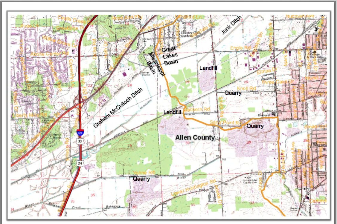
“Of primary concern are the Silver and Bighead carp which have been expanding their habitats within the Mississippi River basin for at least the past twenty years where they have decimated native fish populations by as much as 97 percent in some areas. These fish are currently threatening to enter the Great Lakes, a valuable fresh water resource.” THIS is the specific location they are able to cross from the Mississippi via the Wabash to the Great Lakes via the St. Marys/Maumee.
“Asian carp have been known to exist within the Wabash River for nearly 20 years. However, in May 2010 Indiana DNR observed Asian Carp eggs and spawning behavior much further upstream on the Wabash than was previously anticipated. The Wabash River was a “dead‐ end” for these fish as the Roush Dam prevents Asian carp from reaching the headwaters of the Wabash River. However, the Little River connects to the Wabash below the dam and its headwaters ebb into marshland on the southwestern edge of Fort Wayne, Indiana. Due to its proximity to the Maumee River system and recent flood events that have occurred within the floodplains between these two systems, there may be an opportunity for Asian carp to swim across the drainage divide at this location between the Great Lakes and the Mississippi River Basins. This is a critical concern because the Maumee River flows into Lake Erie, thus providing Asian carp with a potential for direct access to the Great Lakes.”
 http://www.asiancarp.us/documents/Wabash-Maumee-Field-Report_Final_small.pdf
Proposed Interim Measures:
Inspect and increase/reinforce existing berm as necessary.
Fencing from Graham McCulloch Ditch berm to railroad embankment
Place mesh grates at the ends of underground conduits or cover the openings on both ends with large rock to allow water to flow through but impede fish passage.
Potential Long‐Term Measures:
Potential for a physical separation measure with a water level control structure located within or to the west of Eagle Marsh.
Potential fortification of Huntington Dam.
Save Maumee remains concerned about the lack of any plan, IF the Asian Carp DO make it into the Great Lakes. We are unaware of any reports, hypotheses or theories; what is the educated guess, as to the plan, if the Asian Carp are IN Lake Erie?
